Kamchatka is the eastern outskirts of vast Russia. Today this peninsula is the tourist pearl of our country. Kamchatka is famous for its majestic volcanoes, relict groves, thermal springs, clear lakes, an amazing valley of geysers, diverse flora and fauna, practically untouched by civilization.
But these fertile lands endowed with harsh beauty became part of the Russian state relatively recently, a little more than three centuries ago. This is explained not only by Kamchatka’s distance from the capital, but also by its inaccessibility. The peninsula, stretching for 1200 kilometers, is connected to the mainland by a narrow isthmus; it is washed by the Sea of Okhotsk from the west, the Pacific Ocean from the east, and the icy waters of the Bering Sea from the northeast. It took Russian people almost half a century to begin to seriously explore the peninsula after its discovery. But who discovered Kamchatka? This question is quite interesting and deserves a detailed discussion.
Antiquity
According to excavations and research, the oldest human footprints in Kamchatka are approximately 14,000 years old. Not far from the village of Kozyrevsk, archaeologists found human sites with fire pits, remains of dwellings and stone tools.
In those days, the Bering Strait did not yet exist; people could move between continents. There were glaciers on the mountains, and the tundra between them was teeming with herds of deer, bison, and shaggy mammoths. Hunters in search of rich prey gradually moved from south to north. In fact, they were the ones who first discovered Kamchatka.
About 10,000 years ago, glaciers began to melt rapidly. America and Asia were separated by a strait that was insurmountable for ancient people. Water significantly flooded the shores of Kamchatka, turning it into an almost isolated peninsula. The people who settled on it became the ancestors of modern indigenous peoples, who lived here unknown to the rest of the world until the middle of the 17th century, when those who discovered the territory of Kamchatka for the second time came.
Exploits of the Explorers
The Far East and most of Siberia were developed with the help of explorers. As a rule, they were desperate Cossacks, shrewd merchants and fishermen. They were attracted by the unexplored lands lying to the east of the Russian Empire. In search of fortune and at the behest of the state, these harsh people voluntarily exposed themselves to dangers and hardships. They explored new lands, conquered the peoples they encountered by force or promises, and brought with them Orthodoxy and the power of the sovereign.
They were the ones who discovered Kamchatka. Who exactly did this? It is believed that he and his detachment were the first Russian explorer to visit the peninsula; this happened in 1650. Following him, the detachments of Ivan Kamchatov came to Kamchatka in 1658-1661, and a few years later - the Cossack detachment of Ivan Rubets. These people would be the first to explore and discover Kamchatka; they even collected yasak (fur donation) from the local residents.

Atlasov's merits
But still, spontaneous and short-lived campaigns cannot be called full-fledged development of the peninsula. It was ahead. And here the question arises: which traveler truly discovered Kamchatka, paved the way for thousands of Russian people who subsequently settled in these lands and made them finally Russian.
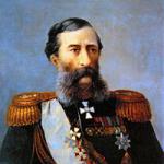
It was Vladimir Vasilyevich Atlasov. His life and death are connected with Kamchatka. He was born into a mixed family of Yakut and Cossack in 1661. His service began in Yakutsk in 1682. With the rank of foreman, he collected yasak in the Amur, Anadyr, and Indigirka regions. In 1695, he rose to the position of clerk (leader) of the fort in Anadyr. In 1696 he sent a reconnaissance detachment to Kamchatka under the command of Luka Morozko.

And in 1697 he went to the peninsula himself, at the head of a rather large detachment for those times of 60 Yukaghirs and 65 Cossacks. Moreover, the authorities did not want to provide supplies and money for the expedition; Atlasov spent his own funds. Having passed the isthmus, the detachment split into two parts. The first - under the leadership of Atlasov - moved along the western coast of Kamchatka. The second - led by the Cossack Morozko - went along the eastern bank. However, this tactic almost turned into a tragedy.
Vladimir Vasilyevich’s team encountered numerous local hunters who did not want to pay tribute and attacked strangers: three Cossacks were killed, several were wounded, including Atlasov. The two detachments hastily united. In July 1697, the expedition put a big end to it. It meant that the peninsula, with all its wealth and people, belonged to the Russian Empire.
During his glorious campaign, Atlasov carefully collected information about Kamchatka. He described the peoples, animals and plants living on it, for the first time mentioned mineral springs and volcanoes, and compiled the first decent drawings of the area. In a word, he became the one who discovered Kamchatka and its potential value for the central government. It is not surprising that it was Vladimir Vasilyevich who went to the capital in 1701 for a detailed report on the newly annexed lands.
Development of Kamchatka in the 18th century
Following Atlasov's expedition, active settlement of the peninsula began. Its first Russian inhabitants were the Cossacks. In 1703, Rodion Presnetsov’s detachment reached Avachinskaya Bay, where the city of Petropavlovsk would later appear. Over the course of several years, Kamchatka was covered from north to south; by 1711, three full-fledged forts were built on the peninsula.
However, the virtual absence of central authority and the harsh disposition of the Cossacks became the cause of lawlessness and oppression of the indigenous inhabitants. The development of new lands turned into robbery and arbitrariness. The Cossacks, who collected yasak, humiliated the hunters and their relatives, beating them, turning them into slaves and demanding excessive tribute.
To put an end to lawlessness, in 1707 a proven man, Atlasov, was sent to the peninsula, who eagerly took on the difficult task. He organized a normal collection of yasak, reined in reckless heads and fairly punished crimes, thereby making many enemies for himself. In 1711, one of the conflicts led to a conspiracy and the murder of Atlasov by the Cossacks, who no longer wanted to tolerate his power. Thus ended the glorious life of the one who discovered Kamchatka for thousands of future settlers who subsequently developed its territories.
Sea route
But the settlement of the peninsula by people was greatly complicated by its inaccessibility. The harsh climate, vast distances, taiga, mountains and tundra became an obstacle for people. A simpler and safer way was needed. On water. The sea route to Kamchatka was first established in 1716, when the Vostok boat, leaving Okhotsk, crossed the sea and reached the Kamchatka coast.
Then there was the famous Bering expedition, which, in addition to the strait of the same name, explored the eastern coast of Kamchatka and reached Avacha Bay. Several expeditions followed. Thanks to them, convenient sea routes and the distant peninsula were finally studied and mapped. From now on, getting to it has become much easier not only for immigrants and servicemen, but also for scientists who want to study Kamchatka.

Krasheninnikov's work
In fact, Stepan Petrovich Krasheninnikov is the one who discovered Kamchatka in the 18th century for the scientific community and ordinary people. Born into a family of soldiers in 1711, Stepan Petrovich became an authoritative scientist and tireless traveler. He began his research work with a Siberian expedition led by Johann Gmelin in 1735-1736. Krasheninnikov visited Lake Baikal and the Yenisei, Tom, and Lena rivers.
Having gained experience, in 1737 he decided on an independent expedition to Kamchatka, going there by sea from Okhotsk. However, not far from the coast of the peninsula, the ship began to sink. The team barely escaped, and the traveler lost a significant part of his equipment. But this could not quench the ardor and thirst for knowledge of the young scientist. In less than three years, from the spring of 1738 to the winter of 1740, Stepan Petrovich literally traveled around Kamchatka.
Internal routes along the peninsula amounted to more than 3,000 kilometers, the studied coastline was 1,700 kilometers. Krasheninnikov was a truly universal scientist, at the same time showing himself as a zoologist and botanist, ethnographer and historian, as a geographer and linguist. He collected a huge amount of invaluable information about Kamchatka.

The result of this amazing man’s expedition was a monumental scientific work with the simple title “Description of the Land of Kamchatka,” which Stepan Petrovich completed in 1751. A masterpiece and example of ethnographic and geographical writing was soon translated into four European languages. He still remains in demand. The last Russian reissue of the work was relatively recently, in 1994.
Left a reply Guest
Key dates.Traveler's name.His contribution to the development of geographical knowledge about the territory of Russia.
1.1620-1623 (way to the East) - to Chukotka and Kamchatka.Panteley Demidovich Penda.Discoverer of the Lena River. Penda climbed the Yenisei from Turukhanskado to the Lower Tunguska, then walked for three years to its upper reaches. He reached the Chechuysky portage, crossed the portage, sailed down the Lena River to the city of Yakutsk, to the mouth of the Kulenga, then through the Buryat steppe to the Angara, where, having boarded a ship, he arrived in Turukhansk through Yeniseisk.
2.1639-1640 Ivan Moskvitin.He was the first European to reach the Sea of Okhotsk. He was the first to visit Sakhalin. The coast of the Sea of Okhotsk for 1300 km, Udskaya Bay, Sakhalin Bay, Amur Estuary, the mouth of the Amur and Sakhalin Island was discovered and surveyed.
3.1628-1655Pyotr Beketov.Voivode, explorer of Siberia. The founder of a number of Siberian cities, such as Yakutsk, Chita, Nerchinsk. In 1628-1629 he took part in campaigns along the Angara. I walked a lot along the tributaries of the Lena. He founded several sovereign forts on the Yenisei, Lena and Transbaikalia.
4.1641-1652 Mikhail Vasilievich Stadukhin.Russian explorerexplorer of North-Eastern Siberia, one of the first to reach the Kolyma, Anadyr, Penzhina and Gizhiga rivers and the northern part of the Sea of Okhotsk. He was the first to cross the Oymyakon Plateau.At the beginning of the summer of 1643, Stadukhin descended the Indigirkek Sea and headed east. In July 1643 he opened the mouth of the Kolyma and going up the river to the middle reaches, he discovered the Kolyma Lowland.
5.1630-1635 Vasily Ermolaevich Bugor.In 1630-1635 Vasily Bugor discovered new lands in Siberia and the Far East, identified a significant part of the Lena basin, traced its entire course (4400 km), as well as a number of tributaries.
6.1633-1634 Ivan Rebrov.In 1633-1634 explorers led by Ivan Rebrovwent along the Lena River to the Arctic Ocean. Expedition Rebrova was the first to descend to the mouth of the Lena, opening Olenyok Baywith the Olenok River (1634)
7.1643-1646 Vasily Poyarkov.Russian explorer, Cossack. Discoverer of the Middle and Lower Amur. In 1643-1646 he led a detachment that was the first Russian to penetrate the Amur River basin, discover the Zeya River, and the Zeya Plain. He collected valuable information about the nature and population of the Amur region.
8.1649-1653 Erofey Khabarov.B1649-53 made a trip along the Amur from where the Urka River flows into it to the very lower reaches. As a result of his expedition, the Amur indigenous population accepted Russian citizenship. He often acted by force, which left him with a bad reputation among the indigenous population.
9.1648-1649 Semyon Dezhnev.Cossack ataman, explorer, traveler, sailor, explorer of Northern and Eastern Siberia. Participated in the discovery of Kolyma as part of Stadukhin’s detachment. From Kolyma, on kochakhs, he traveled across the Arctic Ocean along the northern coast of Chukotka. 80 years before Vitus, Bering was the first European in 1648 to cross the (Bering) Strait separating Chukotka and Alaska.
10.1648Popov Fedot Alekseevich.Russian trader, organizer and expedition participant1648, which opened the strait (Bering Strait) between Asia and North America , from the Arctic Ocean to the Pacific.
11.
1696-1697 Vladimir Atlasov.Experienced polar explorer. ABOUT organized an expedition to explore Kamchatka at the beginning of 1697. Atlasov was not the discoverer of Kamchatka, but he was the first Russian to walk the entire peninsula from north to south and west to east. He drew up a detailed map of his journey. His report contained detailed information about the climate, flora and fauna. For the annexation of Kamchatka to Russia, Vladimir Atlasov, by government decision, was appointed clerk there.
Without Russian discoverers, the world map would be completely different. Our compatriots - travelers and sailors - made discoveries that enriched world science. About the eight most noticeable ones - in our material.
Bellingshausen's first Antarctic expedition

In 1819, the navigator, captain of the 2nd rank, Thaddeus Bellingshausen led the first round-the-world Antarctic expedition. The purpose of the voyage was to explore the waters of the Pacific, Atlantic and Indian oceans, as well as to prove or disprove the existence of the sixth continent - Antarctica. Having equipped two sloops - "Mirny" and "Vostok" (under the command), Bellingshausen's detachment went to sea.
The expedition lasted 751 days and wrote many bright pages in the history of geographical discoveries. The main one was made on January 28, 1820.
By the way, attempts to open the white continent had been made before, but did not bring the desired success: a little luck was missing, and perhaps Russian perseverance.
Thus, the navigator James Cook, summing up the results of his second voyage around the world, wrote: “I went around the ocean of the southern hemisphere in high latitudes and rejected the possibility of the existence of a continent, which, if it could be discovered, would only be near the pole in places inaccessible to navigation.”
During Bellingshausen's Antarctic expedition, more than 20 islands were discovered and mapped, sketches of Antarctic species and the animals living there were made, and the navigator himself went down in history as a great discoverer.
“The name of Bellingshausen can be directly placed alongside the names of Columbus and Magellan, with the names of those people who did not retreat in the face of difficulties and imaginary impossibilities created by their predecessors, with the names of people who followed their own independent path, and therefore were destroyers of barriers to discovery, which designate epochs,” wrote the German geographer August Petermann.
Discoveries of Semenov Tien-Shansky

Central Asia at the beginning of the 19th century was one of the least studied areas of the globe. An undeniable contribution to the study of the “unknown land” - as geographers called Central Asia - was made by Pyotr Semenov.
In 1856, the researcher’s main dream came true - he went on an expedition to the Tien Shan.
“My work on Asian geography led me to a thorough acquaintance with everything that was known about inner Asia. I was especially attracted to the most central of the Asian mountain ranges - the Tien Shan, which had not yet been touched by a European traveler and was known only from scanty Chinese sources.
Semenov's research in Central Asia lasted two years. During this time, the sources of the Chu, Syr Darya and Sary-Jaz rivers, the peaks of Khan Tengri and others were mapped.
The traveler established the location of the Tien Shan ridges, the height of the snow line in this area and discovered the huge Tien Shan glaciers.
In 1906, by decree of the emperor, for the merits of the discoverer, the prefix began to be added to his surname - Tien Shan.

Asia Przhevalsky

In the 70−80s. XIX century Nikolai Przhevalsky led four expeditions to Central Asia. This little-studied area has always attracted the researcher, and traveling to Central Asia has been his long-time dream.
Over the years of research, mountain systems have been studied Kun-Lun , ridges of Northern Tibet, sources of the Yellow River and Yangtze, basins Kuku-nora and Lob-nora.
Przhevalsky was the second person after Marco Polo to reach lakes-swamps Lob-nora!
In addition, the traveler discovered dozens of species of plants and animals that are named after him.
“Happy fate made it possible to make a feasible exploration of the least known and most inaccessible countries of inner Asia,” Nikolai Przhevalsky wrote in his diary.
Kruzenshtern's circumnavigation

The names of Ivan Kruzenshtern and Yuri Lisyansky became known after the first Russian round-the-world expedition.
For three years, from 1803 to 1806. - that’s how long the first circumnavigation of the world lasted - the ships “Nadezhda” and “Neva”, having passed through the Atlantic Ocean, rounded Cape Horn, and then through the waters of the Pacific Ocean reached Kamchatka, the Kuril Islands and Sakhalin. The expedition clarified the map of the Pacific Ocean and collected information about the nature and inhabitants of Kamchatka and the Kuril Islands.

During the voyage, Russian sailors crossed the equator for the first time. This event was celebrated, according to tradition, with the participation of Neptune.
The sailor, dressed as the lord of the seas, asked Krusenstern why he came here with his ships, because the Russian flag had not been seen in these places before. To which the expedition commander replied: “For the glory of science and our fatherland!”
Nevelsky Expedition

Admiral Gennady Nevelskoy is rightfully considered one of the outstanding navigators of the 19th century. In 1849, on the transport ship “Baikal”, he went on an expedition to the Far East.
The Amur expedition lasted until 1855, during which time Nevelskoy made several major discoveries in the area of the lower reaches of the Amur and the northern shores of the Sea of Japan, and annexed the vast expanses of the Amur and Primorye regions to Russia.
Thanks to the navigator, it became known that Sakhalin is an island that is separated by the navigable Tatar Strait, and the mouth of the Amur is accessible for ships to enter from the sea.
In 1850, Nevelsky’s detachment founded the Nikolaev post, which today is known as Nikolaevsk-on-Amur.
“The discoveries made by Nevelsky are invaluable for Russia,” wrote Count Nikolai Muravyov-Amursky “Many previous expeditions to these regions could have achieved European glory, but none of them achieved domestic benefit, at least to the extent that Nevelskoy accomplished it.”
North of Vilkitsky

The purpose of the hydrographic expedition of the Arctic Ocean in 1910-1915. was the development of the Northern Sea Route. By chance, captain 2nd rank Boris Vilkitsky took over the duties of the voyage leader. Icebreaking steamships "Taimyr" and "Vaigach" went to sea.
Vilkitsky moved through the northern waters from east to west, and during his voyage he was able to compile a true description of the northern coast of Eastern Siberia and many islands, received the most important information about currents and climate, and also became the first to make a through voyage from Vladivostok to Arkhangelsk.
The expedition members discovered the Land of Emperor Nicholas I., known today as Novaya Zemlya - this discovery is considered the last significant one on the globe.
In addition, thanks to Vilkitsky, the islands of Maly Taimyr, Starokadomsky and Zhokhov were put on the map.
At the end of the expedition, the First World War began. The traveler Roald Amundsen, having learned about the success of Vilkitsky’s voyage, could not resist exclaiming to him:
“In peacetime, this expedition would excite the whole world!”

Kamchatka campaign of Bering and Chirikov

The second quarter of the 18th century was rich in geographical discoveries. All of them were made during the First and Second Kamchatka expeditions, which immortalized the names of Vitus Bering and Alexei Chirikov.
During the First Kamchatka Campaign, Bering, the leader of the expedition, and his assistant Chirikov explored and mapped the Pacific coast of Kamchatka and Northeast Asia. Two peninsulas were discovered - Kamchatsky and Ozerny, Kamchatka Bay, Karaginsky Bay, Cross Bay, Providence Bay and St. Lawrence Island, as well as the strait, which today bears the name of Vitus Bering.
Companions - Bering and Chirikov - also led the Second Kamchatka Expedition. The goal of the campaign was to find a route to North America and explore the Pacific Islands.
In Avachinskaya Bay, the expedition members founded the Petropavlovsk fort - in honor of the ships "St. Peter" and "St. Paul" - which was later renamed Petropavlovsk-Kamchatsky.

When the ships set sail to the shores of America, by the will of an evil fate, Bering and Chirikov began to act alone - due to fog, their ships lost each other.
"St. Peter" under the command of Bering reached the west coast of America.
And on the way back, the expedition members, who had to endure many difficulties, were thrown onto a small island by a storm. This is where Vitus Bering’s life ended, and the island where the expedition members stopped for the winter was named after Bering.
Chirikov’s “Saint Paul” also reached the shores of America, but for him the voyage ended more happily - on the way back he discovered a number of islands of the Aleutian ridge and safely returned to the Peter and Paul prison.
"Unclear Lands" by Ivan Moskvitin

Little is known about the life of Ivan Moskvitin, but this man nevertheless went down in history, and the reason for this was the new lands he discovered.
In 1639, Moskvitin, leading a detachment of Cossacks, set sail to the Far East. The main goal of the travelers was to “find new unknown lands” and collect furs and fish. The Cossacks crossed the Aldan, Mayu and Yudoma rivers, discovered the Dzhugdzhur ridge, separating the rivers of the Lena basin from the rivers flowing into the sea, and along the Ulya River they reached the “Lamskoye”, or Sea of Okhotsk. Having explored the coast, the Cossacks discovered the Taui Bay and entered the Sakhalin Bay, rounding the Shantar Islands.
One of the Cossacks reported that the rivers in the open lands “are sable, there are a lot of all kinds of animals, and fish, and the fish are big, there are no such fish in Siberia... There are so many of them - you just need to launch a net and you can’t drag them out with fish...”.
Geographic data collected by Ivan Moskvitin formed the basis of the first map of the Far East.
XVI century. A new stage of geographical discoveries in the land expanses of Russia begins. The legendary Ermak reached the Irtysh and marked the beginning of the development of Siberia - “a harsh and gloomy country.” It’s like he’s opening the gates to the east, into which troops of Cossacks, industrialists and people simply looking for adventure are rushing. XVII century. It was in this century that the map of the eastern lands of Russia begins to take on certain shapes - one discovery follows another. The mouth of the Yenisei has been reached, the routes of Russian Europeans stretch across the harsh highlands of Taimyr, the routes of Russian Europeans stretch along the harsh highlands of Taimyr, Russian sailors go around the Taimyr Peninsula. For the first time, our compatriots see the great mountains of Eastern Siberia, the rivers: Lena, Olenek, Yana. It is no longer nameless heroes who create the history of Russian geography - their names become widely known.
Ataman Ivan Moskvitin stops his horse on the shore of the Pacific Ocean. Serviceman Semyon Ivanovich Dezhnev sets off on a long journey. He had to experience a lot: “...I laid down my head, suffered great wounds and shed my blood, and endured a great cold and died of starvation.” This is what he will say about himself - but isn’t this the usual fate of all Russian pioneers?! Having descended on Indigirka, Dezhnev reaches the shores of the Arctic Ocean. Another time, together with Fedot Alekseevich Popov, he goes out into the ocean along the Kolyma, goes around the Chukotka Peninsula and opens the Anadyr River. An exceptionally difficult path - and no less important in terms of the results achieved; However, Dezhnev is not destined to know that he made a great geographical discovery - he discovered the strait separating Asia and America. This will become clear only 80 years later thanks to the expedition of Vitus Bering and Alexei Chirikov. At the very end of the 17th century, Vladimir Atlasov began exploring Kamchatka and founded the first Russian settlement there - Verkhnekomchatsk. For the first time he sees the northern extremities of the Kuril ridge. A little time will pass and the Russians' first "blueprint" of the Kuril Archipelago in the 17th century, expeditions in Russia, begin to receive thoughtful government support.
Rice. 1. Map of the advance of Russian explorers to the east
Ermak Timofeevich
Ermak Timofeevich (between 1537-1540, the village of Borok on the Northern Dvina - August 5, 1585, the bank of the Irtysh near the mouth of Vagai), Russian explorer, Cossack ataman, conqueror of Western Siberia (1582-1585), hero of folk songs. Ermak's surname has not been established, but in the 16th century many Russian people did not have surnames. He was called either Ermak Timofeev (after his father’s name) or Ermolai Timofeevich. Ermak's nickname is Tokmak.
Back in 1558, the Stroganovs received the first charter for the “abundant places of Kama”, and in 1574 - for the lands beyond the Urals along the Tura and Tobol rivers and permission to build fortresses on the Ob and Irtysh. Around 1577, the Stroganovs asked to send Cossacks to protect their possessions from attacks by the Siberian Khan Kuchum. At the behest of Ivan the Terrible, Ermak’s squad arrived in Cherdyn (near the mouth of the Kolva) and Sol-Kamskaya (on the Kama) to strengthen the eastern border of the Stroganov merchants. Probably in the summer of 1582 they concluded an agreement with the ataman on a campaign against the “Siberian Sultan” Kuchum, supplying them with supplies and weapons.
Having led a detachment of 600 people, Ermak began a campaign deep into Siberia in September, ascended the Chusovaya River and its tributary Mezhevaya Utka, and moved to Aktai (Tobol basin). Ermak was in a hurry: only a surprise attack guaranteed success. The Ermakovites descended to the area of the present city of Turinsk, where they scattered the Khan’s vanguard. The decisive battle took place on October 23-25, 1582 on the banks of the Irtysh, at Cape Podchuvash: Ermak defeated the main forces of the Tatars of Mametkul, Kuchum’s nephew, and on October 26 entered Kashlyk, the capital of the Siberian Khanate (17 km from Tobolsk), found there many valuable goods and furs . The remnants of the defeated Tatar horde migrated to the south, to the steppe. Four days later, the Khanty came to Ermak with food supplies and furs, followed by local Tatars with gifts. Ermak greeted everyone with “kindness and greetings” and, imposing taxes (yasak), promised protection from enemies. In early December, Mametkul's warriors killed a group of Cossacks fishing on Lake Abalak, near Kashlyk. Ermak overtook the Tatars and destroyed almost everyone, but Mametkul himself escaped.
To collect yasak on the lower Irtysh in March 1583, Ermak sent a party of mounted Cossacks. When collecting tribute, they had to overcome the resistance of the local population. After the ice drift, the Cossacks descended the Irtysh on plows. In riverine villages, under the guise of tribute, they took away valuables. Along the Ob, the Cossacks reached the hilly Belogorye, where the river, skirting the Siberian Uvaly, turns north. Here they found only abandoned dwellings, and on May 29 the detachment turned back. Fearing an uprising of the local population, Ermak sent 25 Cossacks to Moscow for help, who arrived in the capital at the end of the summer. The Tsar rewarded all participants in the Siberian campaign, forgave state criminals who had sided with Ermak earlier, and promised to send 300 archers to help. The death of Ivan the Terrible disrupted many plans, and the archers reached Ermak only at the height of the uprising raised by Karachi (Kuchum’s advisor).
Small groups of Cossacks, scattered across the vast territory of Western Siberia, were killed, and the main forces of Ermak, together with reinforcements from Moscow, were blocked in Kashlyk on March 12, 1585. The supply of food stopped, famine began in Kashlyk; many of his defenders died. At the end of June, in a night raid, the Cossacks killed almost all the Tatars and captured a food train; the siege was lifted, but Ermak had only about 300 fighters left. A few weeks later he received false news about a trade caravan heading to Kashlyk. In July, Ermak with 108 Cossacks set out from Kashlyk to meet the caravan at the mouth of the Vagai and Ishim, defeating Tatar detachments there. On the rainy night of August 6, Kuchum unexpectedly attacked the Cossack camp and killed about 20 people, Ermak also died. According to legend, the wounded Ermak tried to swim across the Vagai River, a tributary of the Irtysh, but drowned due to his heavy chain mail. 90 Cossacks escaped in plows. The remnants of the Cossack squad under the command of M. Meshcheryak retreated from Kashlyk on August 15 and returned to Rus'. Part of Ermak’s detachment remained to winter in the Ob town. (Appendix 3)
Ivan Yuryevich Moskvitin
Moskvitin Ivan Yuryevich, Russian explorer, discoverer of the Far East, the Sea of Okhotsk, and Sakhalin Island.
Cossack service. A native of the Moscow region, Moskvitin began serving no later than 1626 as an ordinary Cossack in the Tomsk prison. Probably participated in the campaigns of Ataman Dmitry Kopylov to the south of Siberia. In the winter of 1636, Kopylov, at the head of a detachment of Cossacks, including Moskvitin, went to the Lena region for booty. They reached Yakutsk in 1637, and in the spring of 1638 they descended the Lena to Aldan and climbed it for five weeks using poles and whips. 265 km. On July 28, above the mouth of the Mai River, the Cossacks set up the Butalsky fort.
To the Sea of Okhotsk. From the Evenks, Kopylov learned about the silver mountain on the lower Amur. The lack of silver in the state forced him in May 1639 to send Moskvitin (now a foreman) with 30 Cossacks to search for the deposit. Six weeks later, having subjugated the entire local population along the way, the explorers reached the Yudoma River (a tributary of the Mai), where, abandoning the plank, they built two kayaks and went up to its source. They overcame an easy pass through the Dzhugdzhur ridge they discovered in a day and ended up on the Ulya River, flowing to the “ocean sea.” Eight days later, waterfalls blocked their path - they had to abandon the kayaks. Having built a boat that could accommodate up to 30 people, they were the first Russians to reach the shores of the Sea of Okhotsk. The explorers spent the entire journey through unknown terrain a little more than two months, eating “trees, grass and roots.”
On the Ulye River, Moskvitin cut down a winter hut - the first Russian village on the Pacific coast. From local residents he learned about a densely populated river in the north and, postponing until spring, he went there on October 1 on a river “boat” at the head of a group of 20 Cossacks. Three days later they reached this river, called the Hunt. Moskvitin returned to Ulya two weeks later, taking the amanats. The voyage to the Hunt on a fragile boat proved the need to build a more reliable sea vessel. In the winter of 1639-40. The Cossacks built two 17-meter kochas - the history of the Pacific Fleet began with them. To the shores of Sakhalin. In November 1639 and April 1640, the explorers repelled the attacks of two large groups of Evens (600 and 900 people). From a prisoner, Moskvitin learned about the southern river “Mamur” (Amur), at the mouth of which and on the islands live “sedentary Gilyaks” (sedentary Nivkhs). In the summer, the Cossacks sailed south, taking a prisoner as a “leader”. They followed along the entire western coast of the Sea of Okhotsk to the Uda Bay and entered the mouth of the Uda. Here, from local residents, Moskvin received new information about the Amur, as well as the first information about the Nivkhs, Nanais and “bearded people” (Ainu). The Moskvitians headed east, went around the Shantar Islands from the south and, passing into the Sakhalin Gulf, visited the northwestern coast of Sakhalin Island.
Moskvitin apparently managed to visit the Amur Estuary and the mouth of the Amur. But the food was already running out, and the Cossacks turned back. The autumn stormy weather did not allow them to reach Ulya, and they settled for the winter at the mouth of the Aldoma River, 300 km away. South of Ulya. And in the spring of 1641, having again crossed Dzhugdzhur, Moskvitin went to Maya and arrived in Yakutsk with “sable” booty. The results of the campaign turned out to be significant: the coast of the Sea of Okhotsk was discovered for 1300 km, Udskaya Bay, Sakhalin Bay, Amur Estuary, the mouth of the Amur and Sakhalin Island.
Vasily Danilovich Poyarkov
The exact years of his life are unknown. Explorer and navigator, explorer of the Sea of Okhotsk, discoverer of the Lower Amur, Amur Estuary and the southwestern part of the Sea of Okhotsk, “written head”. In June 1643, at the head of a military detachment of 133 people, he set out from Yakutsk on a campaign to the Amur to collect tribute and annex the lands lying to the east up to the Sea of Okhotsk. The detachment went down the Lena to Aldan, then climbed up it to the rapids (discovering the Uchur and Golan rivers along the way). He left ships with some of the people here for the winter, crossed the watershed lightly on skis with a detachment of 90 people, discovered the Zeya River and wintered in its upper reaches at the mouth of the Umlekan River. In the spring of 1644, ships were dragged there, on which the detachment went down the Zeya and Amur to its mouth, where they again spent the winter. From the Amur Nivkhs we received valuable information about Sakhalin and the ice regime in the strait separating the island from the mainland. In the spring of 1645, having attached additional sides to the river planks, the detachment entered the Amur Lebanon and, moving along the shore of the Sea of Okhotsk to the north, reached the Ulya River. He spent his third winter there. In the early spring of 1646, he rode up the river on a sled, crossed the watershed and returned to Yakutsk along the rivers of the Lena basin. Subsequently he served in Yakutsk, Tobolsk and Kurgan Sloboda in the Urals. A mountain on the island of Sakhalin and a village in the Amur region are named after Poyarkov.
Erofey Pavlovich Khabarov
Khabarov Erofey Pavlovich (between 1605 and 1607, the village of Dmitrievo, Vologda province - early February 1671, the village of Khabarovka, Irkutsk province), Russian explorer, explorer of Eastern Siberia. In 1649-1653 he made a number of campaigns in the Amur region, compiled “Drawing of the Amur River” 1. The first years of activity. Coming from Pomor peasants, in the winter of 1628 Khabarov went to work in Mangazeya, reached Kheta and until the spring of 1630 served as a duty collector in the Kheta winter quarters. In 1632 he arrived on the Lena and until 1639 he walked along its tributaries Kuta, Kiringa, Vitim, Olekma and Aldan, hunting for sable.
Having put together an artel, he exchanged the mined “soft junk” for goods for the local population in Siberian cities. During his wanderings, he collected information about the Lena and its tributaries, about the peoples living here, about the mineral resources of the region. Khabarov became the discoverer of salt springs at the mouth of the Kuta and discovered “pleasant lands” there for arable land. By the spring of 1641, the first farmer in this region raised about 28 hectares of virgin soil, built the first salt pan in Eastern Siberia, established the sale of salt and got horses to transport government goods to Yakutsk. In the same year, the governor illegally took away Khabarov’s buildings, grain reserves and income from the treasury. Then he moved to the mouth of Kirenga, plowed 65 hectares and received a good harvest of cereals. The voivode soon appropriated this farm too, and for refusing to lend money, he requisitioned 48 tons of bread from Khabarov, tortured him and imprisoned him, where he spent almost 2.5 years.
Upon his release, Khabarov continued to engage in farming. Built a mill. Amur epic. When Khabarov heard rumors about the riches of the Amur lands, he curtailed his profitable business, gathered a band of “eager people,” arrived in Ilimsk, and in March 1649 received permission from the new governor to go to the Amur. He took military equipment, weapons, and agricultural implements on credit and, at the head of a group of 60 people, left Ilimsk in the spring of 1649. The loaded plows slowly ascended the fast and rapids Olekma. The detachment spent the winter at the mouth of the Tungir, but back in January 1650, having made sledges and loaded boats on them, they began dragging through the snow across the high Stanovoy Range. From there the detachment headed along the tributaries down to the Amur. Dauria began here with its uluses and even small towns. A local woman I met along the way told about the luxury of the country beyond the Amur, whose ruler has an army with “fire combat” and cannons. Khabarov, leaving about 50 people in a half-empty town on Urka, returned to Yakutsk on May 26, 1650 and began to spread exaggerated rumors about the riches of the new “zemlitz”. Appointed as Dauria’s “orderly man,” he set out from Yakutsk with 150 volunteers in the summer and arrived on the Amur in the fall. The Russians spent the winter in the captured town, and in the spring, having built several planks and plows, they began rafting down the Amur River past the villages that the residents themselves had burned.
At the end of September 1651, Khabarov stopped near Lake Bolon for another winter. In March 1652, he defeated a detachment of two thousand Manchus and moved further up the Amur, stopping only to collect yasak. But people were tired of constant movement, and in early August 132 rebels fled on three ships. They reached the lower reaches of the Amur, where they cut down a fort. In September, Khabarov approached the prison, took it after the siege, and flogged the “disobedient” with batogs and a whip, from which many died. He spent the fourth winter there, and in the spring of 1653 he returned to the mouth of the Zeya. In the summer, his people sailed up and down the Amur, collecting tribute. Meanwhile, news of the exploits of the explorers reached Moscow, and the government sent an official of the Siberian Order, D.I. Zinoviev, with a detachment of 150 people to the Amur. The royal envoy arrived in August 1653 with awards to all participants in the campaign. Taking advantage of the complaints of people dissatisfied with Khabarov, he removed Khabarov from leadership, accused him of crimes, arrested him and took him to Moscow. However, Khabarov was found not guilty. A year later, Khabarov was granted “children of the boyars”, given a number of villages in Siberia to “feed”, but was forbidden to return to the Amur. Between 1655 and 1658, he conducted trade transactions in Ustyug the Great and returned to the Lena no later than the summer of 1658. In the fall of 1667, in Tobolsk, Khabarov informed the compilers of the “Drawing of All Siberia” information about the upper reaches of the Lena and the Amur. In January 1668, in Moscow, he again asked the tsar to let him go to the Amur, but having been refused, he returned to the Lena and three years later died in his settlement at the mouth of the Kirenga. He had a daughter and a son.
Semyon Ivanovich Dezhnev
Dezhnev Semyon Ivanovich (c. 1605-73), Russian explorer. In 1648, together with F.A. Popov (Fedot Alekseev), he sailed from the mouth of the Kolyma to the Pacific Ocean, rounded the Chukotka Peninsula, opening the strait between Asia and America. 1. Cossack service. Dezhnev, a native of Pomor peasants, began his Siberian service as an ordinary Cossack in Tobolsk. In the early 1640s. with a detachment of Cossacks he moved to Yeniseisk, then to Yakutsk. He served in the detachment of Dmitry Zyryan (Yarily) in the Yana basin. In 1641, having received an appointment to Mikhail Stadukhin’s detachment, Dezhnev and the Cossacks reached the fort on the Oymyakon River. Here they were attacked by almost 500 Evens, from whom they fought back together with yasaks, Tungus and Yakuts.
In search of “new lands,” Dezhnev and Stadukhin’s detachment in the summer of 1643 descended on a koch to the mouth of the Indigirka River, crossed by sea to the lower reaches of Alazeya, where they met Zyryan’s koch. Dezhnev managed to unite both groups of explorers, and they sailed east on two ships. In search of "new lands". In the Kolyma delta, the Cossacks were attacked by the Yukaghirs, but they broke through up the river and set up a fort in the area of modern Srednekolymsk. Dezhnev served in Kolyma until the summer of 1647, and then was included as a yasak collector in the fishing expedition of Fedot Popov. In the summer of 1648, Popov and Dezhnev went to sea on seven boats.
According to the widespread version, only three ships reached the Bering Strait; the rest were caught in a storm. In the fall, another storm in the Bering Sea separated the two remaining Kochas. Dezhnev and 25 companions were thrown back to the Olyutorsky Peninsula, and only 10 weeks later, having lost half of the explorers, they reached the lower reaches of Anadyr. According to Dezhnev himself, six out of seven ships passed through the Bering Strait, and five kochs, including Popov’s ship, died in the Bering Sea or in the Gulf of Anadyr during “bad weather at sea.” Dezhnev and his squad, having overcome the Koryak Highlands, “cold and hungry, naked and barefoot,” reached the shore of Anadyr. Of those who went in search of the camps, only three returned; The Cossacks barely survived the harsh winter of 1648-49, having built river boats before the ice broke up. In the summer, having climbed 600 km, Dezhnev founded a tribute winter hut, where in the spring the detachments of Semyon Motors and Stadukhin came. Led by Dezhnev, they tried to reach the Penzhina River, but, without a guide, they wandered in the mountains for three weeks. Difficult everyday life of explorers. In late autumn, Dezhnev sent people to the mouth of the Anadyr for food. But Stadukhin robbed and beat the harvesters, and he himself went to Penzhina. The Dezhnevites held out until spring, and in the summer and fall they took up the food problem and exploration of “sable places.”
In the summer of 1652, they discovered a huge walrus rookery on the shallows of the Gulf of Anadyr, dotted with walrus tusks ("frozen tooth"). Last years of life. In 1660, Dezhnev with a cargo of “bone treasury” moved by land to the Kolyma, and from there by sea to the lower Lena. After wintering in Zhigansk, he reached Moscow through Yakutsk in the fall of 1664. Here a full settlement was made with him: for his service and fishing of 289 poods (just over 4.6 tons) of walrus tusks worth 17,340 rubles, Dezhnev received 126 rubles and the rank of Cossack chieftain. Appointed as a clerk, he continued to collect yasak on the Olenek, Yana and Vilyui rivers. During his second visit to Moscow in 1671, he delivered the sable treasury, but fell ill and died in the beginning. 1673. During his 40 years in Siberia, Dezhnev took part in numerous battles and skirmishes and received at least 13 wounds. He was distinguished by reliability and honesty, self-control and peacefulness. Dezhnev was married twice, and both times to Yakut women, from whom he had three sons (one adopted). His name is given to: the cape, which is the extreme northeastern tip of Asia (called Big Stone Nose by Dezhnev), as well as an island, a bay, a peninsula, and a village. A monument to him was erected in the center of Veliky Ustyug in 1972.
The great Russian travelers, the list of which is quite large, pushed the development of maritime trade and also raised the prestige of their country. The scientific community learned more and more information not only about geography, but also about the animal and plant world, and most importantly, about people who lived in other parts of the world and their customs. Let's follow in the footsteps of the great Russian travelers and their geographical discoveries.
Fedor Filippovich Konyukhov
The great Russian traveler Fyodor Konyukhov is not only a famous adventurer, but also an artist and an Honored Master of Sports. He was born in 1951. From childhood, he was able to do something that would have been quite difficult for his peers - swimming in cold water. He could easily sleep in the hayloft. Fedor was in good physical shape and could run long distances - several tens of kilometers. At the age of 15, he managed to swim across the Sea of Azov using a rowing fishing boat. Fyodor was also significantly influenced by his grandfather, who wanted the young man to become a traveler, but the boy himself also strived for this. Great Russian travelers often began to prepare in advance for their campaigns and sea voyages.

Konyukhov's discoveries
Fyodor Filippovich Konyukhov took part in 40 voyages, repeated Bering’s route on a yacht, and also sailed from Vladivostok to the Commander Islands, visiting Sakhalin and Kamchatka. At the age of 58, he conquered Everest, as well as 7 of the highest peaks in a team with other climbers. He visited both the North and South Poles, he has 4 round-the-world sea voyages, and crossed the Atlantic 15 times. Fyodor Filippovich reflected his impressions through drawing. Thus he painted 3 thousand paintings. The great geographical discoveries of Russian travelers were often reflected in their own literature, and Fyodor Konyukhov left behind 9 books.
Afanasy Nikitin
The great Russian traveler Afanasy Nikitin (Nikitin is the merchant's patronymic, since his father's name was Nikita) lived in the 15th century, and the year of his birth is unknown. He proved that even a person from a poor family can travel so far, the main thing is to set a goal. He was an experienced merchant who, before India, visited Crimea, Constantinople, Lithuania and the Principality of Moldova and brought overseas goods to his homeland.

He himself was from Tver. Russian merchants went to Asia to establish connections with local traders. They themselves transported there mainly furs. By the will of fate, Afanasy ended up in India, where he lived for three years. Upon returning to his homeland, he was robbed and killed near Smolensk. The great Russian travelers and their discoveries will forever remain in history, because for the sake of progress, brave and brave lovers of wanderings often died in dangerous and lengthy expeditions.
Discoveries of Afanasy Nikitin
Afanasy Nikitin became the first Russian traveler to visit India and Persia; on his way back he visited Turkey and Somalia. During his travels, he made notes “Walking across the Three Seas,” which later became a guide for studying the culture and customs of other countries. Medieval India is especially well depicted in his writings. He swam across the Volga, the Arabian and Caspian seas, and the Black Sea region. When merchants were robbed by the Tatars near Astrakhan, he did not want to return home with everyone and fall into debt, but continued his journey, heading to Derbent, then to Baku.
Nikolai Nikolaevich Miklouho-Maclay

Miklouho-Maclay comes from a noble family, but after the death of his father he had to learn what it was like to live in poverty. He had the nature of a rebel - at the age of 15 he was arrested for participating in a student demonstration. Because of this, he not only found himself under arrest in the Peter and Paul Fortress, where he stayed for three days, but was also expelled from the gymnasium with a further ban on enrollment - so the opportunity to obtain a higher education in Russia was lost for him, which he subsequently did only in Germany.
A well-known naturalist, drew attention to the inquisitive 19-year-old young man and invited Miklouho-Maclay on an expedition, the purpose of which was to study marine fauna. Nikolai Nikolaevich died at the age of 42, and his diagnosis was “severe deterioration of the body.” He, like many other great Russian travelers, sacrificed a significant part of his life in the name of new discoveries.
Discoveries of Miklouho-Maclay
In 1869, Miklouho-Maclay, with the support of the Russian Geographical Society, left for New Guinea. The coast where he landed is now called the Maclay Coast. After spending more than a year on the expedition, he discovered new lands. The natives learned from the Russian traveler how pumpkins, corn, beans are grown, and how to care for fruit trees. He spent 3 years in Australia, visited Indonesia, the Philippines, the islands of Melanesia and Micronesia. He also convinced local residents not to interfere with anthropological research. For 17 years of his life he studied the indigenous population of the Pacific Islands and Southeast Asia. Thanks to Miklouho-Maclay, the assumption that the Papuans are a different species of human was refuted. As you can see, the great Russian travelers and their discoveries allowed the rest of the world not only to learn more about geographical exploration, but also about other people living in new territories.
Nikolai Mikhailovich Przhevalsky
Przhevalsky was favored by the emperor's family; at the end of his first trip, he had the honor of meeting Alexander II, who transferred his collection to the Russian Academy of Sciences. His son Nikolai really liked the works of Nikolai Mikhailovich, and he wanted to be his student; he also contributed to the publication of stories about the 4th expedition, donating 25 thousand rubles. The Tsarevich always looked forward to letters from the traveler and was glad even to receive short news about the expedition.

As you can see, even during his life, Przhevalsky became a fairly famous person, and his works and deeds received great publicity. However, as sometimes happens when great Russian travelers and their discoveries become famous, many details from his life, as well as the circumstances of his death, are still shrouded in mystery. Nikolai Mikhailovich had no descendants, because having understood in advance what fate awaited him, he would not allow himself to doom his loved one to constant expectations and loneliness.
Przhevalsky's discoveries
Thanks to Przhevalsky's expeditions, Russian scientific prestige received a new boost. During 4 expeditions, the traveler covered about 30 thousand kilometers; he visited Central and Western Asia, the Tibetan Plateau and the southern part of the Taklamakan Desert. He discovered many ridges (Moscow, Mysterious, etc.) and described the largest rivers in Asia.
Many have heard about (subspecies, but few people know about the rich zoological collection of mammals, birds, amphibians and fish, a large number of records on plants and a herbarium collection. In addition to the animal and plant world, as well as new geographical discoveries, the great Russian traveler Przhevalsky was interested in unknown for European peoples - Dungans, northern Tibetans, Tanguts, Magins, Lobnors. He created the work “How to Travel in Central Asia,” which could serve as an excellent guide for researchers and military personnel. The great Russian travelers, making discoveries, always provided knowledge for the development of science and success. organizing new expeditions.
Ivan Fedorovich Krusenstern
The Russian navigator was born in 1770. He happened to become the head of the first round-the-world expedition from Russia, he is also one of the founders of Russian oceanology, an admiral, a corresponding member and an honorary member of the Academy of Sciences in St. Petersburg. The great Russian traveler Krusenstern also took an active part when the Russian Geographical Society was created. In 1811 he had the opportunity to teach at the Naval Cadet Corps. Subsequently, becoming director, he organized the highest officer class. This academy then became a naval academy.

In 1812, he allocated 1/3 of his fortune for the people's militia (the Patriotic War began). Until this time, three volumes of the books “Travels Around the World” had been published, which were translated into seven European languages. In 1813, Ivan Fedorovich was included in the English, Danish, German and French scientific communities and academies. However, after 2 years he goes on indefinite leave due to a developing eye disease, the situation was complicated by a difficult relationship with the Minister of the Navy. Many famous sailors and travelers turned to Ivan Fedorovich for advice and support.
Krusenstern's discoveries
For 3 years he was the head of the Russian expedition around the world on the ships Neva and Nadezhda. During the voyage, the mouths of the Amur River were to be explored. For the first time in history, the Russian fleet crossed the equator. Thanks to this trip and Ivan Fedorovich, the eastern, northern and northwestern shores of the Sakhalin island appeared on the map for the first time. Also due to his work, the Atlas of the South Sea, supplemented by hydrographic notes, was published. Thanks to the expedition, non-existent islands were erased from the maps, and the exact position of other geographical points was determined. Russian science learned about inter-trade countercurrents in the Pacific and Atlantic oceans, water temperatures were measured (depths up to 400 m), and its specific gravity, color and transparency were determined. Finally, the reason why the sea glowed became clear. Data also appeared on atmospheric pressure, tides and tides in many areas of the World Ocean, which were used by other great Russian travelers in their expeditions.
Semyon Ivanovich Dezhnev
The great traveler was born in 1605. A sailor, explorer and merchant, he was also a Cossack chieftain. He was originally from Veliky Ustyug, and then moved to Siberia. Semyon Ivanovich was known for his diplomatic talent, courage and ability to organize and lead people. Geographical points (cape, bay, island, village, peninsula), award, icebreaker, passage, streets, etc. bear his name.

Dezhnev's discoveries
Semyon Ivanovich, 80 years before Bering, passed the Strait (called the Bering Strait) between Alaska and Chukotka (in its entirety, while Bering passed only part). He and his team discovered a sea route around the northeastern part of Asia and reached Kamchatka. No one had previously known about that part of the world where America almost converged with Asia. Dezhnev crossed the Arctic Ocean, bypassing the northern coast of Asia. He mapped the strait between the American and Asian shores, and after the ship was shipwrecked, his detachment, having only skis and sleds, took 10 weeks to get there (losing 13 out of 25 people). There is an assumption that the first settlers in Alaska were part of Dezhnev’s team, which separated from the expedition.
Thus, following in the footsteps of the great Russian travelers, one can see how the scientific community of Russia developed and rose, knowledge about the outside world was enriched, which gave a huge impetus to the development of other industries.